connect field with office
cloud web portal
works effectively with stx-mc software
On this page:
![]()
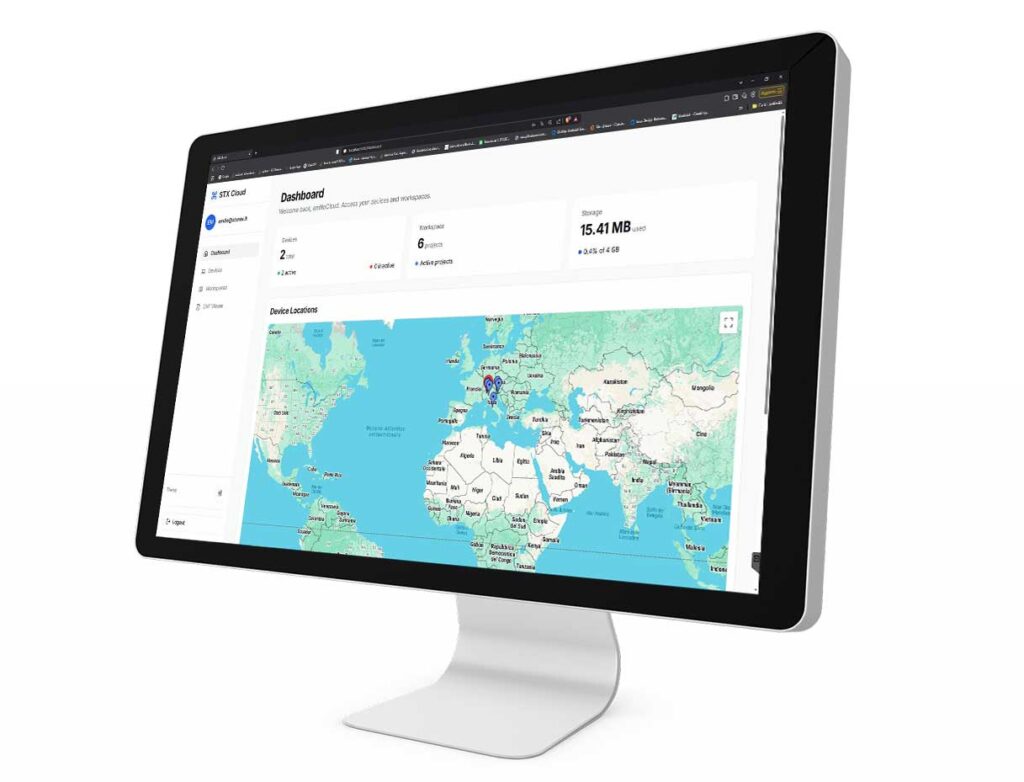
STX-CLOUD is a web portal designed to facilitate the exchange of job data between the office and the job site.
The key communication points include:
The office (accessible via any web browser)
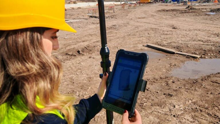
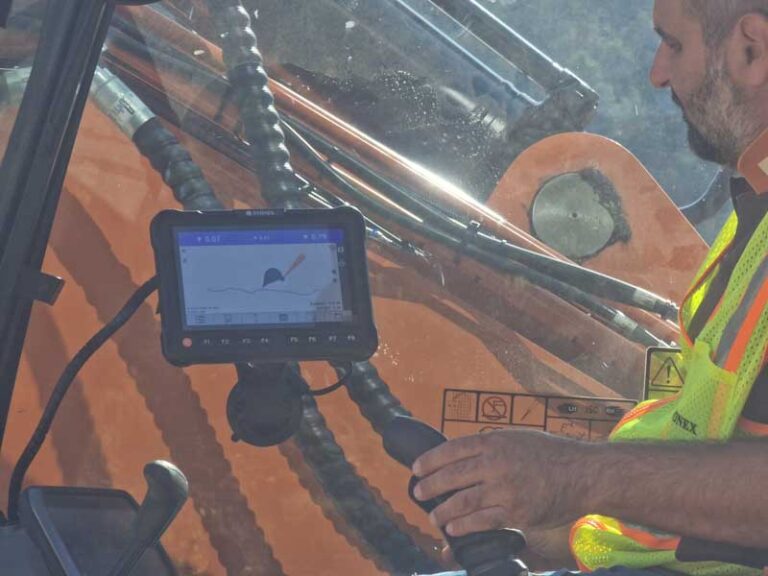
The job site (via any registered MC tablet device)
The surveyor through Cube-a field software (separate license)
Job site data uploaded to the web portal can be assigned to one or more tablet devices—typically those installed in earth-moving machines—either individually or in bulk.
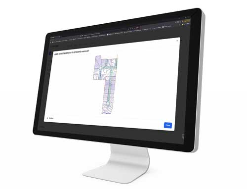
A simple and intuitive user interface allows operators to preview DXF files before uploading them to the server.
From the operator’s perspective, downloading and uploading data through the cloud service is straightforward and user-friendly.
Additionally, the cloud service provides real-time updates on the latest machine locations.
The STX-Cloud allows users to upload and share files (projects, calibration and configuration, localization) between your Apollo tablets, Cube-a devices and office devices (PC/Laptop/tablet) remotely via cloud service, eliminating the need for manual USB transfers to each individual device.
Share the Project Data from the Office to Cloud for one Machine or a Workspace (including several machines)
Share the Project Data from the Field (Cube-a) to the Cloud and to the Machine
Preview a DXF File
Monitoring on the MAP the Machine location
Store in the cloud the Machine Calibration Data
Complete control of your devices and machines
• Job management
• Survey Point Library
• System settings (units, precision, parameters, etc.)
• Import/export ASCII and DXF
• Import/export ESRI shapefiles (with attributes)
• Export Google Earth KML/Send to Google Earth
• Import Raster Image
• Share files by cloud services, e-mail, Bluetooth, Wi-Fi
• Customizable ref. systems also by remote RTCM messages
• Features codes (multiple feature tables)
• Fast Coding Panel
• Define GIS features
• Define GIS attributes
• All brand bluetooth disto support
• Support for Stonex receivers
• Generic NMEA (support for third party receivers) – Rover only
• Receiver status (quality, position, sky view, satellites list, base info)
• Full support for features like E-Bubble, Tilt, Atlas, SureFix
• Network connections management
• Support of RTCM 2.x, RTCM 3.x, CMR, CMR+
• Automatic GNSS model & features detection
• Automatic antenna offset management
• Bluetooth and Wi-Fi GNSS connection
• TS Bluetooth
• TS Long Range Bluetooth
• Search and prism tracking (Robotic only)
• Compensator interface
• Station on point
• Free station / Least squares resection
• TS orientation st.dev. and check orientation
• Topographic basic calculation
• Rotate to GPS position3
• Rotate to given point
• Export TS raw data
• Export mixed GPS+TS raw data
• Grid Scan
In March 2022 Stonex had the opportunity to carry out a series of surveys inside and outside the “Torretta Viscontea” located in the Monza Park.
* Mandatory field